Whether you’re traveling in the backcountry or just off the beaten path, a GPS unit is a must-have. It’s one of the best ways to ensure that you’ll make it back to the car. The technology of GPS has increased dramatically along with the accuracy of tracking. Today’s products are loaded with features that make finding the best hiking GPS a challenge. Let’s point you in the right direction with our round-up of our favorites.
BEST HIKING GPS
| 1 | Bad Elf 2200 GPS Pro | 35 | 2.0 |
| 2 | Garmin GPSMAP 64st | 16 | 2.6 |
| 3 | Garmin Foretrex 401 | 17 | 1.7 |
| 4 | Garmin eTrex Vista HCx | 25 | 2.0 |
| 5 | Garmin Oregon 450 Handheld GPS Navigator | 16 | 3.0 |
Know what you want? Buy your hiking GPS here now!
TOP-RATED HIKING GPS
It wasn’t an easy task, but we managed to wade through the sea of choices to find the best hiking GPS. Our main criteria centered on usability and practical considerations such as battery life and sensitivity.
BAD ELF 2200 GPS PRO
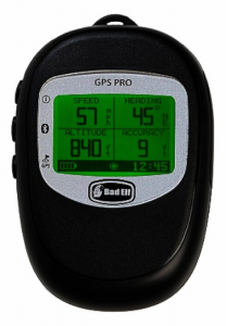
The Bad Elf 2200 GPS Pro like many units creates a total experience with Bluetooth connectivity to a smartphone app. It’s a great example of the advances in technology. However, it comes at a price. You’ll get a decent battery life of 35 hours if it’s not paired with another device. It drops by less than half to 16 hours if it’s paired. Overall, it’s an excellent safety feature despite this effect.
We loved the fact that it provides status information in real-time that is easy to interpret without a lot of guesswork. The LCD screen is large in proportion to the overall size of the unit which makes for easy viewing. It has an impressive 10Hz reporting rate which you can adjust. It’ll log north of 100 hours of data. The manufacturer has its own proprietary app to share your trip data with others.
The design is durable and includes IPX4 water resistance. If you have an Apple phone, you’re in luck because it will work with any location-based app. Unfortunately, there’s no love for Android users as far as the app is concerned. The occasional bug sneaks through testing which is certainly annoying if it happens at the wrong time.
Pros:
- The Bad Elf includes both a mini-USB cable and a 12-24V DC vehicle USB charger.
- We loved the addition of the neck lanyard for ease of use and a hands-free experience.
- The ability to connect with other devices to share the love of your travels is a welcome feature.
Cons:
- The significant loss of battery life when paired negates the benefit of Bluetooth connectivity.
- Its app is only Apple-friendly which is a huge dealbreaker for Android users. Why the hate?
- The occasional bug hampers the user experience.
The Bad Elf 2200 GPS Pro has the advantage of a hands-free interface, but the limited functionality due to bugs and its app are major problems.
GARMIN GPSMAP 64ST
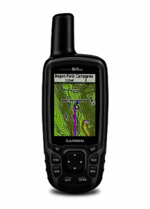
The Garmin GPSMAP 64st has a lot going for it as yet another standup offering from this esteemed manufacturer. Let’s start with power where you can use either two AA batteries or rechargeable ones instead. We love it when manufacturers give us the choice. It has its share of the extras including a 3-axis compass with a barometric altimeter.
The device comes with preloaded TOPO U.S. 100K maps. The resolution isn’t the best, but it does throw in a one-year BirdsEye Satellite Imagery subscription. It has a good screen size of 2.6 inches. We liked the fact that it was a sunlight-readable color screen. That shows some great attention to detail by the manufacturer.
One unexpected but definitely cool feature is 250,000 preloaded geocaches and a carabiner. No more having to go through the painful process of transferring the data. Of course, it hinges on the ability to keep them up-to-date.
Pros:
- Rechargeable batteries can be charged while in the device.
- Garmin makes this device ready to use out-of-the-box with preloaded geocaches.
- It features high sensitivity for improved accuracy.
Cons:
- Many features like smart notifications are Apple only. Seriously? Last we checked, Android was rocking it.
- Downloading new maps is a major drag.
- The Garmin server has its wonky moments that affect the user experience.
The Garmin GPSMAP 64st is what the band Toto would call 99. It has a lot of the things we like in a GPS unit, but the lack of support for Android (!) is not cool.
GARMIN FORETREX 401
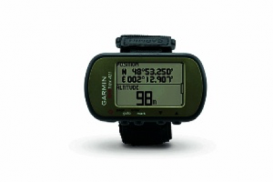
The Garmin Foretrex 401 is the only non-handheld unit we have on our list, but its array of features makes it list-worthy. It is a device that you wear like a watch on your wrist. That makes it more convenient than a handheld unit without the hassle of having to hold it or worrying about it getting lost.
It runs on two AAA batteries. In addition to GPS, you get some extra features that make it a fitness tracker too like a heart rate monitor with this add-on feature. It only makes sense that you’d want to get the most out of a GPS unit with these things. That is one of the reasons that you’re hiking, isn’t it?
It is loaded with a lot of fun features including a barometric altimeter, hunting/fishing information, sunrise/sunset times, and an electronic compass. That makes it the most versatile of all the units we’ve reviewed.
Pros:
- Its waterproof rating is IPX7 which is suitable if you’re caught in the rain or shower.
- Kudos for its proprietaryTracBack® navigation feature!
- You can share and view data on Google Earth, and its Garmin Connect app is Android-friendly. Yeah!
Cons:
- Its interface is a throwback to a 1980s Pong game which is something you may like or hate.
- Its design is a bit clunky and may turn off some users.
- Background maps are very expensive which borders on a dealbreaker.
The Garmin Foretrex 401 has a lot to offer in addition to a hiking GPS unit. It has added functionality which increases its versatility for other uses beyond hiking the backcountry that makes it a worthy contender.
GARMIN ETREX VISTA HCX
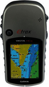
The Garmin eTrex Vista HCx is another example of the excellent technology offered by the manufacturer. It has a highly sensitive WAAS-enabled GPS receiver for reliable accuracy in the field. It is also water resistant which we always appreciate in any electronic device.
It has a few bells and whistles including an electronic compass and a barometric altimeter if changes in elevation are a part of your hiking experience. According to the manufacturer, you can use the latter to keep track of weather changes too. It’s lightweight at just over five ounces. It features a USB interface.
The device has a decent memory capacity for 1,000 waypoints and 50 routes. It also has a hunt/fish calendar along with sun/moon information. You’ll have a basic base map to get you started but unfortunately, there aren’t any more compatible maps to add to this particular unit according to the manufacturer’s website.
Pros:
- Overall, the Garmin eTrex has a nice size with a good hand feel to it.
- It has Bluetooth support which is a definite plus in our book.
- It has a microSD card slot for extra storage for maps. (The card is not included.)
Cons:
- The batteries are not included with the device which struck a bad note with us.
- The manufacturer doesn’t have additional maps for this device.
- The base map included with the unit is low detail.
The Garmin eTrex Vista HCx is a great start but lacks some of the things that its included features make us want to have an all-around hiking GPS.
GARMIN OREGON 450 HANDHELD GPS NAVIGATOR
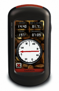
The Garmin Oregon 450 Handheld GPS Navigator is the base model of this series. You can upgrade to get a camera and preloaded topographic maps. As is, this one has a good-sized touchscreen display. It comes with a base map with shaded relief.
It has extra goodies including a barometric altimeter and an accelerometer. It also has a nice hand feel that seems durable enough to handle whatever your adventures will bring. It is water-resistant. Its WAAS-enabled GPS receiver is highly sensitive and features Garmin’s proprietary HotFix® satellite prediction technology.
We love the fact that Garmin is so geocaching-friendly with compatibility for GPX files. They are all about getting the most out of your GPS device with free trip-planning software and the ability to share the maps with others. That’s a big plus from a safety perspective too.
Pros:
- It has great satellite reception.
- The Garmin Oregon 450 is compatible with several types of maps making it a versatile unit.
- Its free software, BaseCamp, allows you to plan your trips ahead of time.
Cons:
- The display isn’t the best for low-light conditions or in bright sun.
- The battery life leaves something to be desired.
- The extra maps, while nice, are spendy.
The Garmin Oregon 450 Handheld GPS Navigator has a lot to offer with the extras that are included with it. Unfortunately, the problems with the display are a major drawback.
After reviewing the specs and the features, our pick for the best hiking GPS is the Garmin Foretrex 401. We immediately fell in love with the fact that it was a hands-free device. Whenever you’re talking about something handheld, there’s always the risk of losing it. The unit was Android-friendly which we really liked.
We figured we could live with the old-school display. The functionality really spoke to us with its high waterproof rating and its TracBack® navigation. Those are the types of features we feel are essential when hiking in the backcountry. The display is easy to read. And you can’t beat the convenience of the on-demand knowledge of where you’re headed.
Yes, it’s a bit on the clunky side, but you can say the same for a lot of the smartwatches out there too. For what you get, we’ll give it a pass on that score. For our money, the Garmin Foretrex 401 ticks off all the boxes for the best hiking GPS.
HIKING GPS BUYERS GUIDE
BENEFITS OF A HIKING GPS
The primary advantage of using a GPS unit is, of course, knowing where you’re at in the field. But there’s more to it than simply not getting lost. You also can see what lies ahead so that you can pick better routes to traverse. That can help you avoid a steep climb up some gnarly hills if you know of a better easier path to follow.
Using a background topo map can alert you to possible hazards like wetlands, streams, or ravines. It puts you in charge of matching the hike to your abilities—and energy. The industry has taken off in recent years thanks to major changes in the information you get from a device.
In 2000, former President Bill Clinton changed the GPS industry forever when he ordered the military to cease scrambling the signals. The accuracy went from 200 to 20 feet with the stroke of a pen. If you thought using a GPS device was fun before, it has skyrocketed to a whole new level now. But even with these advances in technology, we are obliged to add one crucial caveat.
It’s vital to always carry a map and compass with you, especially if you’re hiking in unfamiliar territory. A GPS unit won’t help you navigate under a heavy tree canopy or in a valley. Batteries drain. By the way, cloud cover will not impact the unit’s performance. Your map is your insurance policy in the wild.
HOW TO CHOOSE A GPS UNIT
You have several options for choosing a GPS device going from an app on your phone to a handheld unit with all the bells and whistles. For the purposes of this article, we’re focusing only on dedicated GPS units for serious navigation rather than smartphone apps. That said, some of what we cover will apply to them too. The difference lies in durability and functionality.
BASIC FEATURES
You should consider some of the features of the things you’d look for with any new piece of equipment such as weight. With a GPS unit, it means balancing this trait with the size of the screen. Newer devices typically run under a half of pound so it’s not a dealbreaker usually. The hand feel is probably more important if you’re going to be holding it for extended periods.
The other thing to investigate is how you interact with it. You’ll find units with touchscreens or buttons that you can push to control their functions. The difference is a personal preference though you may consider the latter if you intend to do a lot of winter hiking. You’ll need a pair of touchscreen-friendly gloves to avoid removing them every time you want to use the device.
ADVANCED FEATURES
Many GPS units include a lot of extra features that may have specialized applications. That’s why it’s important to think about the terrains and the ways you’ll use them to rule out the ones that are simply overkill. That’s not to say that they’re useless, but not everyone is going to need a barometric altimeter or wireless transmission.
A decent GPS device can set you back several hundred dollars. The smart thing is to focus on the basic functionality you need and forgo the fancy stuff unless it’s something you really must have to be safe. You’ll see units with other things like a camera. If you have a smartphone, it’s redundant to have another one. The chances are that your phone has a better one anyway.
A couple of things we can recommend in this sphere are an electronic compass and preloaded maps. The first one is a godsend for navigation because it’ll tell you what direction you’re headed even if you’re standing still. With many units, you have to walk several feet before you know what direction you’re walking.
The second just makes sense because you’re ready to hit the trails right away. Otherwise, you’ll have to purchase them separately which will add to your upfront costs. If you’re hiking in the backcountry, topo maps are crucial with the higher the resolution, the better. Unfortunately, they can cost a pretty penny to buy separately. Not all units have the necessary storage space either.
GEOCACHING
Let’s face it. Geocaching has rocked the GPS industry. Navigation is nice for trying to get directions to a new place, but geocaching has made technology a household word. That said, we kept this feature in mind when reviewing the device. We wanted one that would make it easier. That meant a sensitive GPS receiver when you’re getting down to those last feet.
We also put a premium on preloaded base maps. After all, you want to know the best way to approach a destination with a geocache too. We’d be willing to compromise a bit on the resolution as long as it provided a decent picture of what the terrain looked like so we know what to expect.